Poster #004, Earthquake Geology
Late Pleistocene slip rate and 3D geometry of the Mid-Channel blind thrust, Santa Barbara Channel, CA, and their implications for earthquake hazards
Poster Image:

Poster Presentation
2020 SCEC Annual Meeting, Poster #004, SCEC Contribution #10389 VIEW PDF
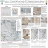
The offshore Mid-Channel blind-thrust fault is located in the Santa Barbara Channel in the southern portion of the western Transverse Ranges. The fault is north dipping and overlain by an asymmetric anticline with a narrow steep forelimb and a wider, more gentle dipping backlimb. The structure is doubly plunging and trends generally north-west, south-east with a slight bend in the middle. The Mid-Channel anticline lies in greater water depth (> 110 meters) than many other active structures in the Santa Barbara Channel and therefore anticlinal structure preserves a nearly complete section of late Pleistocene growth strata above the Mid-Channel fault. These units have been well studied with high-resolution seismic surveys and piston cores collected on Melville cruises in 2005 and 2008 to infer basin deposition rates and paleoclimate (e.g., Nicholson et al., 2006; Marshall., 2012; Behl et al., 2016). Here, we use these horizons to provide chronostratigraphic estimates on rates of folding and uplift, which are used to calculate fault slip rates.
In addition to the dated horizons and shallow seismic, we also use high-resolution industry seismic reflection data, well data, and detailed bathymetric data to define the 3-D geometry of the Mid-Channel structure. We present sections to characterize the geometry of the structure along strike and use fault-bend folding and trishear theories to describe its kinematic evolution. We generate a 3D model of the fault to define the lateral terminations of the structure and its dip variations along strike. Structural relief of the late Pleistocene horizons is measured along strike across the fold and used to calculate slip on the Mid-Channel thrust using this 3D fault model. Based on the geochronology of the horizons, we use these displacements to calculate the late Pleistocene slip rates on the Mid-Channel fault. Together, the 3D geometry of the fault and its Late Pleistocene slip rate help determine the seismic hazards associated with the Mid-Channel fault and structures that it may link to at depth, which together pose a threat to the coastal populations of southern California that border the Santa Barbara Channel.
In addition to the dated horizons and shallow seismic, we also use high-resolution industry seismic reflection data, well data, and detailed bathymetric data to define the 3-D geometry of the Mid-Channel structure. We present sections to characterize the geometry of the structure along strike and use fault-bend folding and trishear theories to describe its kinematic evolution. We generate a 3D model of the fault to define the lateral terminations of the structure and its dip variations along strike. Structural relief of the late Pleistocene horizons is measured along strike across the fold and used to calculate slip on the Mid-Channel thrust using this 3D fault model. Based on the geochronology of the horizons, we use these displacements to calculate the late Pleistocene slip rates on the Mid-Channel fault. Together, the 3D geometry of the fault and its Late Pleistocene slip rate help determine the seismic hazards associated with the Mid-Channel fault and structures that it may link to at depth, which together pose a threat to the coastal populations of southern California that border the Santa Barbara Channel.


