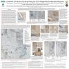
Poster #001, Earthquake Geology
Late-Quaternary slip rates along the plate boundary Magallanes Fault System, Patagonia
Poster Image:

Poster Presentation
2020 SCEC Annual Meeting, Poster #001, SCEC Contribution #10670 VIEW PDF
el Fuego region. Fieldwork (including structure from motion surface models), coastal and marine investigations in and around the MFS demonstrate that Late-Quaternary geological slip rates across faults in the system are on the order of 10.5 ± 1.5 mm/yr (Chile). In Argentina these rates are at least 7.8 ± 1.3 mm/yr, however this only accounts for the master Magallanes fault here, other faults remain uncharacterized. The faults are sub-parallel in general, although in Argentina they perhaps merge. Whereas to the west of Tierra Del Fuego, distance between faults appears to widen up to >100 km (perhaps due to influence of the nearby subduction zone involving the Antarctic and Scotia Plates). Although we have first order slip rate information, and there historic recorded events up to Ms 7.8 in 1949, timing of events along each of the main faults in the system is unknown, nor is recurrence intervals nor how these faults in the MFS interact. However new analysis suggests that at least two of the faults the master Magallanes fault and the Deseado faults have ruptured at least once in the past 500 years. Through comparison of regional models with our results contemporary plate boundary deformation is narrow, approximately ~20–50 km wide from Tierra Del Fuego and east (one of the narrowest on Earth), that widens and becoming more diffuse from Cabo Froward north and west (>100 km wide). Ongoing analysis of marine data are helping to constrain the slip rates here and aid with understanding of fault rupture hazards related to critical infrastructure. Additionally these faults should be considered important sources of crustal seismic hazard and incorporated into the Chilean building code which is focused on subduction zone megathrust ground motions.
SHOW MORE
SHOW MORE


