
Group A, Poster #109, Earthquake Geology
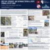
The 2026-04-13 M5.7 Lake Lahontan, NV Earthquake: coseismic damage, aftershocks and afterslip


Poster Image:
Poster Presentation
2026 SCEC Annual Meeting, Poster #109, SCEC Contribution #15594 VIEW PDF
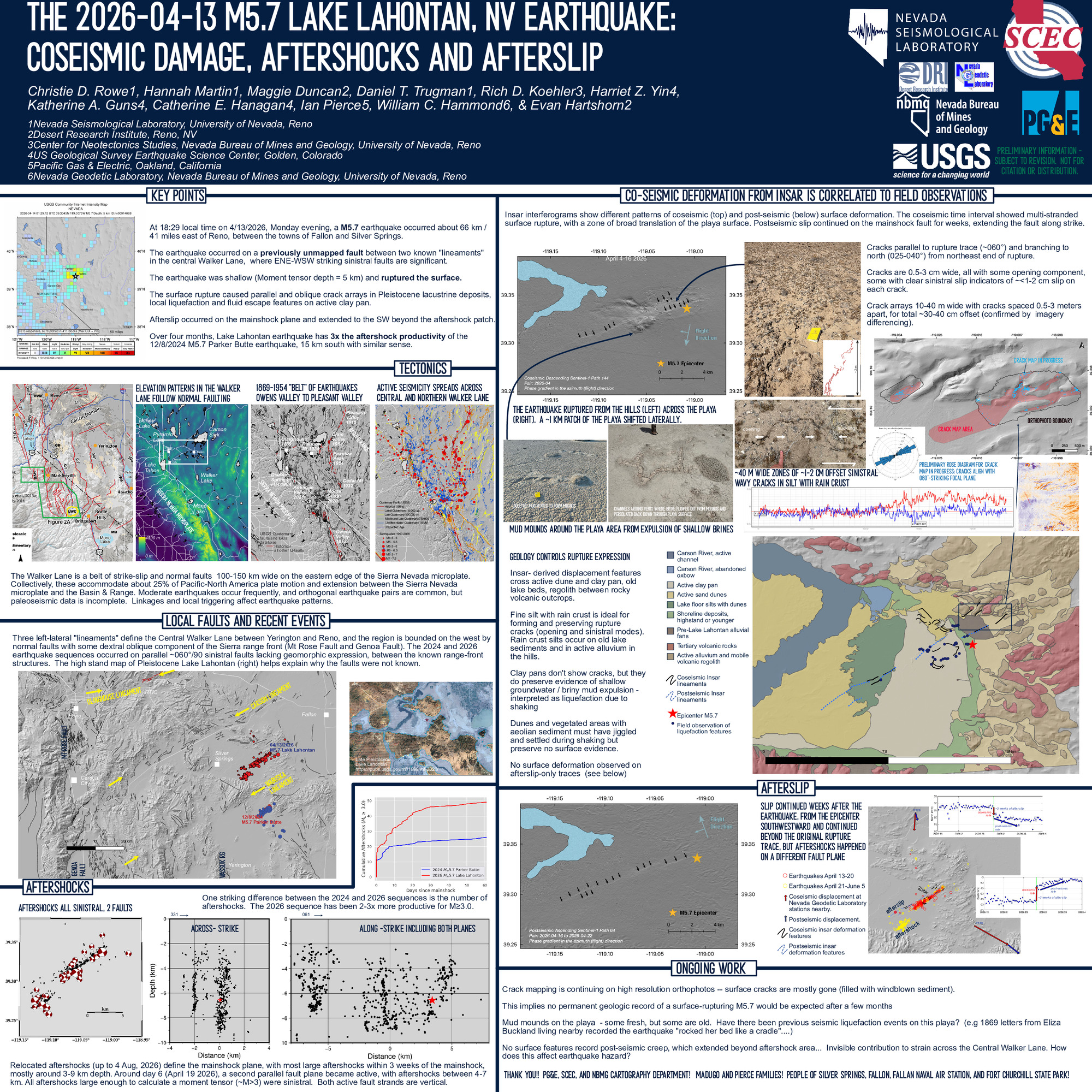
cture array. These are best preserved in ~14 ka Lake Lahontan highstand shoreline silts but not preserved in the rubbly volcanic exposures. Along strike, an area of playa surface about 1 km across translated slightly, and its perimeter is marked by clusters of low mounds of dried mud, some with summit depressions, which we interpret as vent structures formed by liquefaction and expulsion of muddy brine during the earthquake.
Four days after the mainshock, aftershocks started on a parallel structure, offset ~1 km to the south-southwest of the western end of the mainshock plane. Around the same time, Sentinel-1 interferograms identified aseismic slip along the mainshock plane, and extending along strike to the southwest, not co-located with the second aftershock plane. No surface deformation features were discovered in the afterslip area, but geodetic measurements at a nearby EarthScope Network of the Americas station showed significant postseismic displacement consistent with afterslip occurred for several weeks.
The Lake Lahontan earthquake produced ~ 3x more detectable aftershocks than a similar M5.7 sinistral earthquake that occurred in December 2024, 15 km to the south, near Parker Butte in the northern Mason Valley. In the Parker Butte event, dextral aseismic triggered slip occurred on an orthogonal structure (both the main and orthogonal structures were previously unmapped, but geomorphic and field evidence for both faults was discovered after the earthquakes). Together, these events demonstrate that the Walker Lane fault maps are incomplete, that faults with no geomorphic expression are still capable of producing damaging earthquakes, and show for the first time that aseismic afterslip may contribute to the overall deformation field in the Walker Lane.
SHOW MORE
Four days after the mainshock, aftershocks started on a parallel structure, offset ~1 km to the south-southwest of the western end of the mainshock plane. Around the same time, Sentinel-1 interferograms identified aseismic slip along the mainshock plane, and extending along strike to the southwest, not co-located with the second aftershock plane. No surface deformation features were discovered in the afterslip area, but geodetic measurements at a nearby EarthScope Network of the Americas station showed significant postseismic displacement consistent with afterslip occurred for several weeks.
The Lake Lahontan earthquake produced ~ 3x more detectable aftershocks than a similar M5.7 sinistral earthquake that occurred in December 2024, 15 km to the south, near Parker Butte in the northern Mason Valley. In the Parker Butte event, dextral aseismic triggered slip occurred on an orthogonal structure (both the main and orthogonal structures were previously unmapped, but geomorphic and field evidence for both faults was discovered after the earthquakes). Together, these events demonstrate that the Walker Lane fault maps are incomplete, that faults with no geomorphic expression are still capable of producing damaging earthquakes, and show for the first time that aseismic afterslip may contribute to the overall deformation field in the Walker Lane.
SHOW MORE
Citation: Rowe, C. D., Martin, H., Duncan, M., Trugman, D. T., Koehler, R. D., Yin, H. Z., Guns, K. A., Hanagan, C. E., Pierce, I., Hammond, W. C., & Hartshorn, E. (2026, 08). The 2026-04-13 M5.7 Lake Lahontan, NV Earthquake: coseismic damage, aftershocks and afterslip. Poster Presentation at 2026 SCEC Annual Meeting.
Keywords: afterslip, aftershocks, surface rupture, perishable data, rapid response, shallow deformation, geomorphic expression, co-seismic damage
Relevant SCEC Themes:
Rapid Post-Earthquake Investigations & Communications
MORE POSTERS BY THE AUTHORS
|
|
|
|
|


