Group A, Poster #193, Community Capability Building (CCB)
A Virtual Reality Experience Combining the California Fault System with Elements of Urban Environment


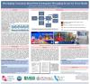
Poster Image:

Poster Presentation
2024 SCEC Annual Meeting, Poster #193, SCEC Contribution #13928 VIEW PDF
The general public's understanding of the spatial extent of active earthquake faults can be inaccurate and misunderstood. Of particular interest is how earthquake faults intersect with urban environments and how citizens perceive (or ignore) the development of metropolitan areas on top of active fault systems. Many misconceptions about earthquakes arise from the difficulty of visualizing the geographic extension of earthquake faults and their dimensions. Outreach and education using interactive tools, such as Virtual Reality (VR), can provide the public context and experiences that simulate and combine geophysical and urban environments. Harnessing VR interactive experiences that include known urban landmarks can help convey a more comprehensive picture of the scale of earthquake faults and their relationship to the built environment. Multiple platforms are available to provide 3D data visualization; creating a VR interactive experience often involves deploying multiple tools. Paraview (.org), MATLAB, Blender, and Unity provide the means to help build and additively enhance VR activities. Paraview allows the generation of 3D interactive VR worlds of scientific data, particularly exploring the California fault system. Blender (.org) provides tools to import Open Street Map (.osm) files and create 3D models of cities like those in Los Angeles County. Our team has integrated buildings and places of interest into a VR Paraview platform jointly with the California fault system. These locations include the Downtown area of Los Angeles, the city of Northridge, the city of Riverside, and the city of Brawley. Furthermore, we are also progressively expanding to include locations in Northern California, such as San Francisco. We have also updated the existing fault network for southern California to the latest version, SCEC CFM 6.1. This allows users to explore with VR an alternative fault system (UCERF3 vs CFM). The addition of buildings and landmarks into the VR activity resulted in a clearer understanding of the scale of earthquake faults and how they develop under densely populated areas. By altering the scale of the VR environment, users can better understand the spatial extent and depth of the faults as the elements of the built environment contrast with the dimensions of the fault structure. Such updated educational activities will help educate citizens about seismic hazard and hopefully contribute to future urban planning and disaster preparedness.
Citation: Carranza, K., Baraggiotta, K. M., & Kyriakopoulos, C. (2024, 09). A Virtual Reality Experience Combining the California Fault System with Elements of Urban Environment. Poster Presentation at 2024 SCEC Annual Meeting.
Keywords: Virtual Reality, California Fault System, Urban Environment, Cities, OpenStreetMap
Relevant SCEC Themes:
Education and Workforce Development
Outreach and Community Engagement