Poster #017, Earthquake Geology
Airborne Thermal-Infrared Spectral Survey of the 2019 Ridgecrest Earthquake Zone and Environs
Poster Image:

Poster Presentation
2020 SCEC Annual Meeting, Poster #017, SCEC Contribution #10366 VIEW PDF
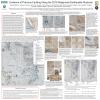
A quick-reaction investigation was undertaken of the area affected by the swarm of major and minor earthquakes that struck the Ridgecrest, CA locale in July 2019. Using surface rupture coordinates derived from USGS field observations, airborne imagery was acquired along the length of the newly created surface rupture features with a wide-swath thermal-infrared (TIR) hyperspectral sensor. Additional areas adjacent to the Ridgecrest fault zone were also surveyed, including the Coso volcanic and geothermal fields, Little Lake fault zone, Panamint Valley fault zone, Searles Valley, and the settlements of Ridgecrest, Inyokern, Trona, and Argus. There were many reports of natural gas leaks and attendant fires in these townships following the earthquakes and the primary goal of the survey was to identify and map natural gas leaks and other potentially hazardous emissions from industrial and commercial facilities resulting from infrastructure damage due to the severe shaking caused by the tremors. However, the imagery acquired during this process also contains information relating to the geology of the area that can be accessed utilizing false-color scene imagery generated by keying on diagnostic TIR spectral signatures presented by the local geology. This form of presentation delineates changes in surface lithology that in turn can be used to visualize rupture tracks and assess the magnitude of slip along active faults.


