
Group B, Poster #104, Earthquake Geology
NOA (naturally occurring asbestos) is underrepresented in Southern California hazard maps and can generate airborne asbestos fibers during large seismic events that trigger earthquake-induced landslides


Poster Image:
Poster Presentation
2026 SCEC Annual Meeting, Poster #104, SCEC Contribution #15625 VIEW PDF
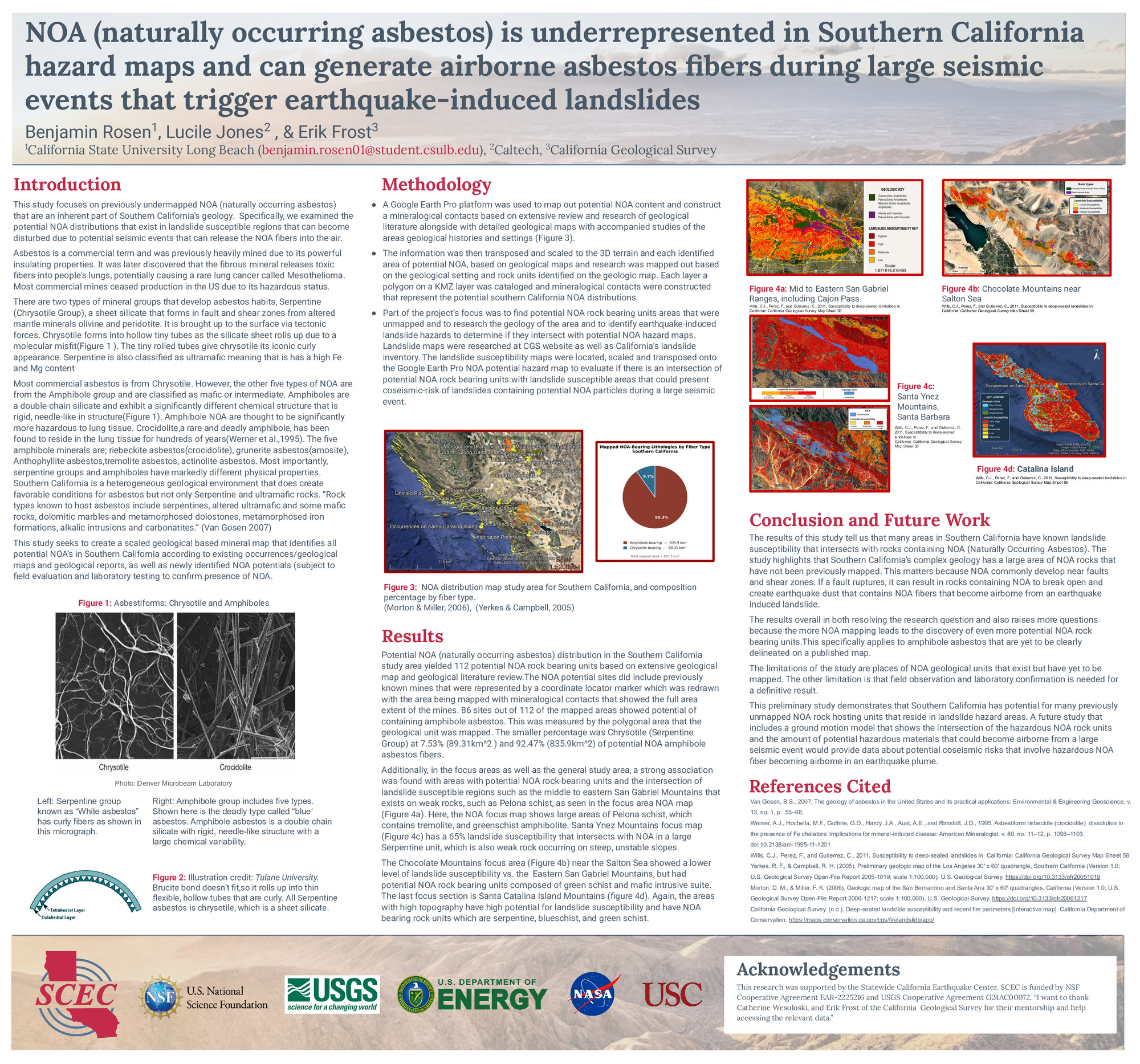
NOA (Naturally Occurring Asbestos) is prominent in the Southern California landscape, and
documented occurrences are known in 10 counties, which are Imperial, San Diego, Riverside, Orange, San Bernardino, Los Angeles, Ventura, Santa Barbara, and San Luis Obispo. NOA is difficult to identify due to Southern California’s complex geological setting and asbestos's varied chemical and structural differences. However, no comprehensive regional map currently delineates the distribution of NOA-bearing geologic units or integrates mineral occurrence data with detailed geologic mapping to identify potential mineral hazards. Existing maps show isolated mines or occurrence locations without showing the extent of NOA rock units.
This study compiled published geologic literature, detailed geologic maps, mineral occurrence databases, and mine records to identify geologic settings favorable for NOA throughout Southern California. Geologic contacts interpreted from these data sets were digitized and transposed into Google Earth Pro KMZ layers to produce a hazardous NOA-bearing rock unit. California Geological Survey EQZapp earthquake-induced landslide susceptibility maps were compared with the mapped hazard areas to evaluate where earthquake-triggered slope failures could intersect potential NOA-bearing rock units. The analysis identified at least 120 previously unrecognized potential NOA hazard areas based on published geological settings, lithologic characteristics, and existing mineral occurrences data. Although these areas require field verification and mineralogical confirmation, the resulting database expands the potential inventory of potential NOA occurrences. This is important because NOA exposure has been a documented health hazard when people are exposed to airborne asbestos fibers and can develop mesothelioma.
The regional asbestos map developed in this study provides a foundation for future investigations that integrate ground-motion models, fault proximity, and earthquake-induced landslide susceptibility to evaluate where a major earthquake could create airborne asbestos fibers in an earthquake-triggered dust plume.
documented occurrences are known in 10 counties, which are Imperial, San Diego, Riverside, Orange, San Bernardino, Los Angeles, Ventura, Santa Barbara, and San Luis Obispo. NOA is difficult to identify due to Southern California’s complex geological setting and asbestos's varied chemical and structural differences. However, no comprehensive regional map currently delineates the distribution of NOA-bearing geologic units or integrates mineral occurrence data with detailed geologic mapping to identify potential mineral hazards. Existing maps show isolated mines or occurrence locations without showing the extent of NOA rock units.
This study compiled published geologic literature, detailed geologic maps, mineral occurrence databases, and mine records to identify geologic settings favorable for NOA throughout Southern California. Geologic contacts interpreted from these data sets were digitized and transposed into Google Earth Pro KMZ layers to produce a hazardous NOA-bearing rock unit. California Geological Survey EQZapp earthquake-induced landslide susceptibility maps were compared with the mapped hazard areas to evaluate where earthquake-triggered slope failures could intersect potential NOA-bearing rock units. The analysis identified at least 120 previously unrecognized potential NOA hazard areas based on published geological settings, lithologic characteristics, and existing mineral occurrences data. Although these areas require field verification and mineralogical confirmation, the resulting database expands the potential inventory of potential NOA occurrences. This is important because NOA exposure has been a documented health hazard when people are exposed to airborne asbestos fibers and can develop mesothelioma.
The regional asbestos map developed in this study provides a foundation for future investigations that integrate ground-motion models, fault proximity, and earthquake-induced landslide susceptibility to evaluate where a major earthquake could create airborne asbestos fibers in an earthquake-triggered dust plume.
Citation: Rosen, B. J., Jones, L. M., Frost, E., Wesoloski, C., & Callen, B. (2026, 08). NOA (naturally occurring asbestos) is underrepresented in Southern California hazard maps and can generate airborne asbestos fibers during large seismic events that trigger earthquake-induced landslides. Poster Presentation at 2026 SCEC Annual Meeting.
Keywords: Asbestos, earthquakes, landslides, amphibole, coseismic hazards, mesothelioma, Naturally Occuring Asbestos
Relevant SCEC Themes:
Earthquake Scenarios for Hazard and Risk Assessment


