Group A, Poster #119, Earthquake Geology
Preservation and interpretation of the geomorphic record of earthquakes


Poster Image:
Poster Presentation
2026 SCEC Annual Meeting, Poster #119, SCEC Contribution #15607 VIEW PDF
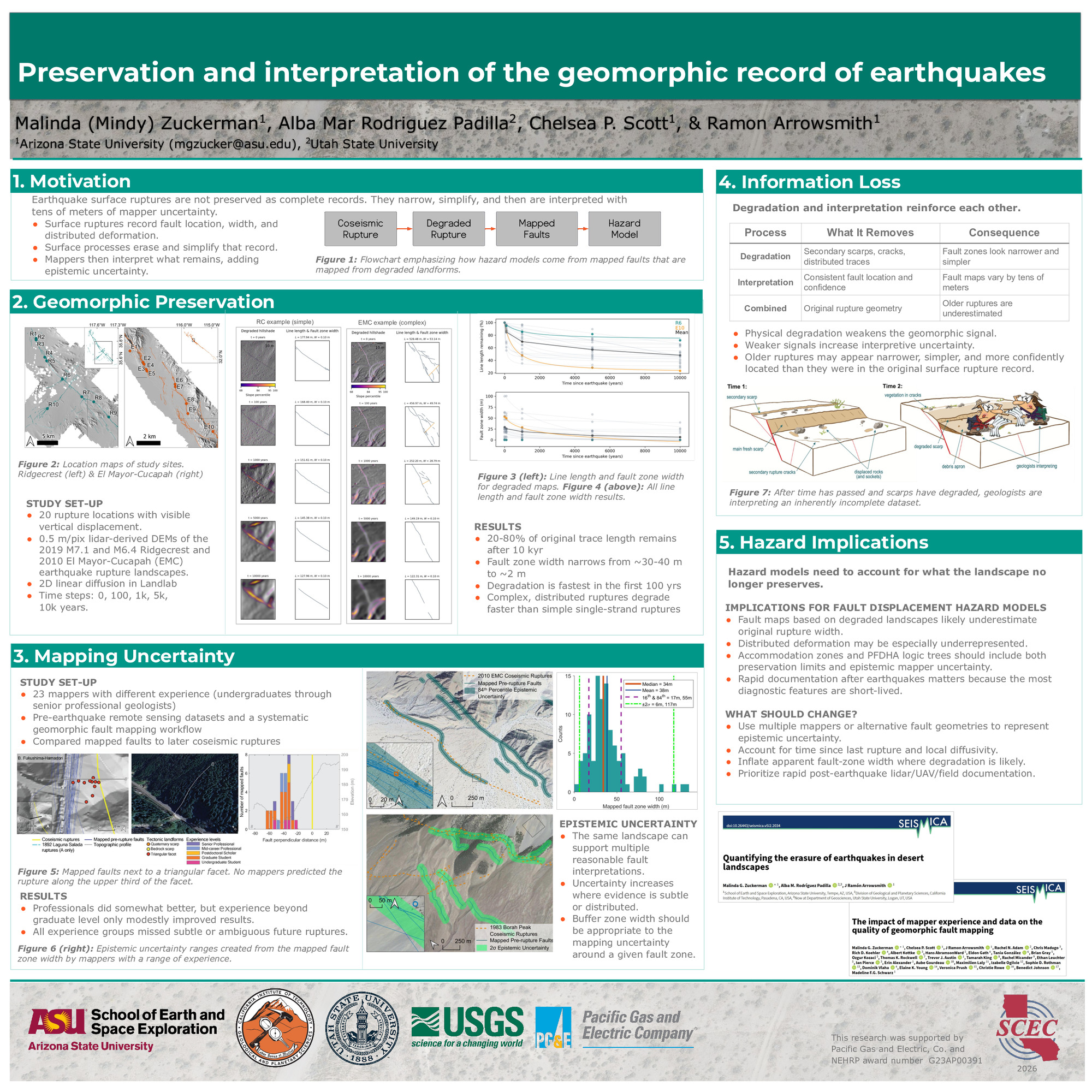
uring the first century after rupture and progressively simplifies over millennial timescales, with only 20–80% of the original fault trace remaining after 10 kyr and apparent fault zone width decreasing from ~30 m to ~2 m. Older ruptures are represented in the geomorphic record by narrower fault zones and fewer preserved fault traces. We conducted a complementary regional mapping experiment that quantifies interpretation uncertainty, showing that even when fault-related landforms are well preserved, independent mappers place faults a median of 34 m from geomorphic indicators of rupture and commonly miss subtle indicators of future rupture. Together, these findings show that the geomorphic record becomes progressively less complete as time since rupture increases. Consequently, reconstructions of older surface ruptures based on human interpretation underestimate the original width, distribution of fault strands, and extent of surface faulting, with important implications for fault characterization and probabilistic fault displacement hazard analyses.
SHOW MORE
SHOW MORE
Citation: Zuckerman, M. G., Rodriguez Padilla, A. M., Scott, C. P., & Arrowsmith, R. (2026, 08). Preservation and interpretation of the geomorphic record of earthquakes. Poster Presentation at 2026 SCEC Annual Meeting.
Keywords: tectonic geomorphology, fault scarp degradation, uncertainty