Group B, Poster #064, Tectonic Geodesy
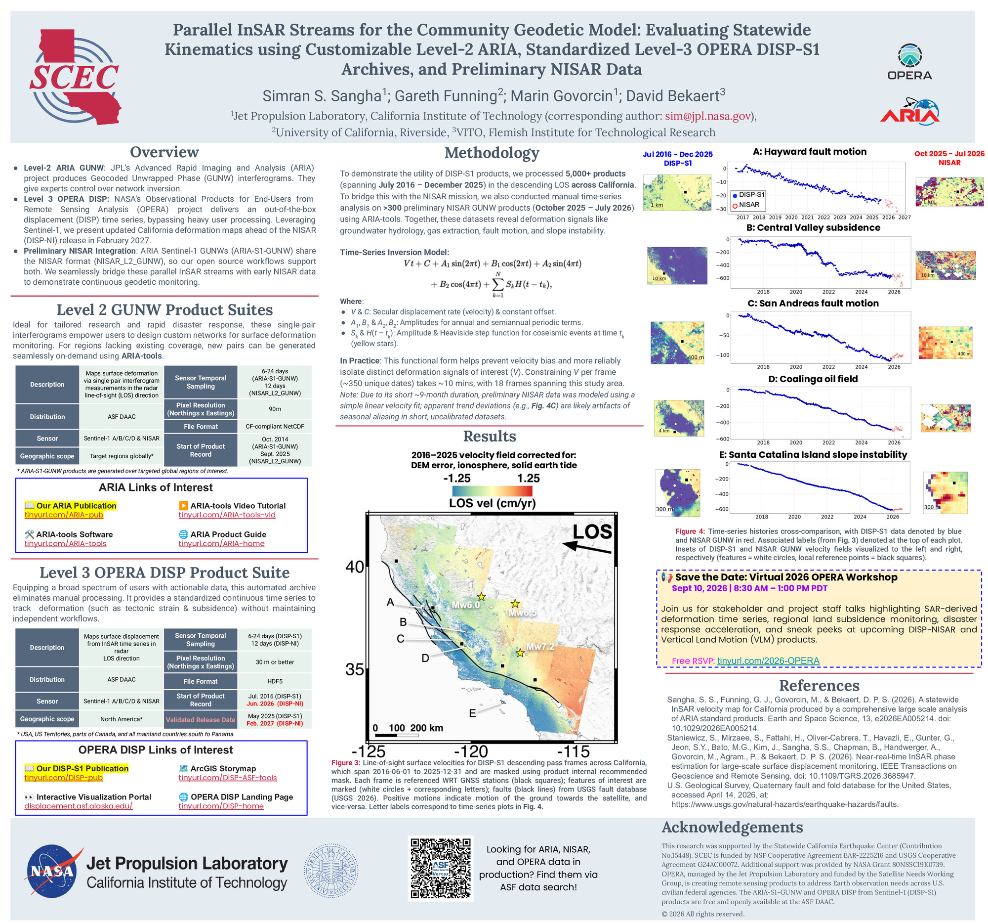
Parallel InSAR Streams for the Community Geodetic Model: Evaluating Statewide Kinematics using Customizable Level-2 ARIA, Standardized Level-3 OPERA DISP-S1 Archives, and Preliminary NISAR Data


Poster Image:
Poster Presentation
2026 SCEC Annual Meeting, Poster #064, SCEC Contribution #15448 VIEW PDF
ntrol over time-series inversions and network design, while the Level-3 OPERA DISP-S1 suite provides a standardized, ready-to-use time-series derived from a hybrid Persistent and Distributed Scatterer approach.
Using the Miami INsar Time-series software in Python (MintPy) and weather-model-based tropospheric corrections, our comprehensive ARIA-derived baseline across nine satellite tracks yields millimeter-per-year agreement with independent Global Navigation Satellite System (GNSS) observations. This statewide dataset successfully captures a diverse array of deformation signals, including:
- Broad right-lateral shear gradients associated with the Pacific-North American plate boundary.
- Sharp velocity discontinuities indicating shallow fault creep along the central San Andreas Fault, contrasted with broad elastic strain accumulation on locked segments.
- Extreme anthropogenic subsidence exceeding 10 cm/yr in the San Joaquin Valley.
- Localized infrastructure and hazard dynamics in the Los Angeles Basin, including subsidence at the Wilmington oil field and horizontal creeping of the Portuguese Bend landslide.
By leveraging this established ARIA velocity field as a high-fidelity benchmark, we are assessing and integrating our newly prepared 2016–2025 OPERA DISP-S1 time-series. We have adapted open-source workflows to handle the 30-meter spatial resolution and HDF5 format of the DISP-S1 products. Ultimately, utilizing both customizable Level-2 and standardized Level-3 archives provides reliable, low-latency updates to the CGM. Building upon these prepared analysis frameworks, we will present a preliminary analysis integrating early NASA-ISRO Synthetic Aperture Radar (NISAR) data to demonstrate their cross-mission adaptability.
SHOW MORE
Using the Miami INsar Time-series software in Python (MintPy) and weather-model-based tropospheric corrections, our comprehensive ARIA-derived baseline across nine satellite tracks yields millimeter-per-year agreement with independent Global Navigation Satellite System (GNSS) observations. This statewide dataset successfully captures a diverse array of deformation signals, including:
- Broad right-lateral shear gradients associated with the Pacific-North American plate boundary.
- Sharp velocity discontinuities indicating shallow fault creep along the central San Andreas Fault, contrasted with broad elastic strain accumulation on locked segments.
- Extreme anthropogenic subsidence exceeding 10 cm/yr in the San Joaquin Valley.
- Localized infrastructure and hazard dynamics in the Los Angeles Basin, including subsidence at the Wilmington oil field and horizontal creeping of the Portuguese Bend landslide.
By leveraging this established ARIA velocity field as a high-fidelity benchmark, we are assessing and integrating our newly prepared 2016–2025 OPERA DISP-S1 time-series. We have adapted open-source workflows to handle the 30-meter spatial resolution and HDF5 format of the DISP-S1 products. Ultimately, utilizing both customizable Level-2 and standardized Level-3 archives provides reliable, low-latency updates to the CGM. Building upon these prepared analysis frameworks, we will present a preliminary analysis integrating early NASA-ISRO Synthetic Aperture Radar (NISAR) data to demonstrate their cross-mission adaptability.
SHOW MORE
Citation: Sangha, S. S., Funning, G. J., Govorcin, M., & Bekaert, D. (2026, 08). Parallel InSAR Streams for the Community Geodetic Model: Evaluating Statewide Kinematics using Customizable Level-2 ARIA, Standardized Level-3 OPERA DISP-S1 Archives, and Preliminary NISAR Data. Poster Presentation at 2026 SCEC Annual Meeting.
Keywords: tectonics, insar, open-access
Relevant SCEC Themes:
Advancing Community Earth Models for Hazard Analyses