
Newly released Alquist-Priolo Earthquake Fault Zones (APEFZs) for the Hayward and Concord faults in the eastern San Francisco Bay Area
Danielle V. Madugo, Carla Rosa, & Judith ZachariasenPublished August 30, 2026, SCEC Contribution #15549, 2026 SCEC Annual Meeting Poster #094 (PDF)
Poster Image:
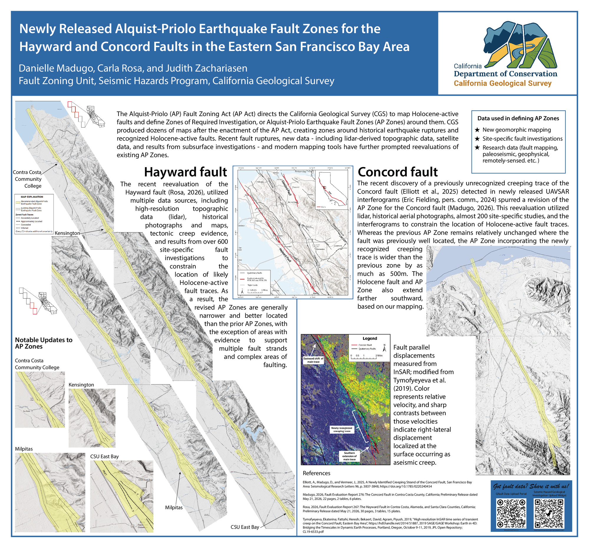
The recent reevaluation of the Hayward fault (Rosa, 2026), utilized multiple data sources, including high-resolution topographic data (lidar), historical photographs and maps, tectonic creep evidence, and results from over 600 site-specific fault investigations to constrain the location of likely Holocene-active fault traces. As a result, the revised AP Zones are generally narrower and better located than the prior AP Zones, with the exception of areas with evidence to support multiple fault strands and complex areas of faulting.
The recent discovery of a previously unrecognized creeping trace of the Concord fault (Elliott et al., 2025) detected in UAVSAR interferograms spurred a revision of the 1990s-vintage AP Zones for the Concord fault (Madugo, 2026). That reevaluation utilized almost 200 site-specific studies to constrain the location of Holocene-active fault traces. Additionally, newly released interferograms aided in accurately mapping creeping sections of the fault along its northern and central sections. While the previous AP Zones remain relatively unchanged where the fault is well-located, the AP Zones incorporating the newly recognized creeping trace is wider by as much as 500m, and the fault was extended farther southward using lidar-based geomorphic mapping.
CGS zoning efforts in progress include the northern Rodgers Creek fault, the peninsular and the Palmdale sections of the San Andreas fault. Anticipated zoning efforts include the Bennett Valley, Wienert, and Dog Valley faults.
Key Words
AP Zones, Hayward fault, Concord fault
Citation
Madugo, D. V., Rosa, C., & Zachariasen, J. (2026, 08). Newly released Alquist-Priolo Earthquake Fault Zones (APEFZs) for the Hayward and Concord faults in the eastern San Francisco Bay Area. Poster Presentation at 2026 SCEC Annual Meeting.
Related Projects & Working Groups
Earthquake Geology


