Causal Inference-Based Seismic Multi-Hazard Estimation for the 2025 Myanmar Earthquake
Yifan Sun, Lingsen Meng, Zhang Yunjun, Yidi Wang, Yanchen Yang, & Changyang HuPublished September 7, 2025, SCEC Contribution #14357, 2025 SCEC Annual Meeting Poster #131 (PDF)
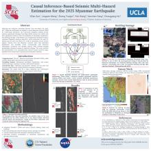
On March 28, 2025, a Magnitude 7.7 earthquake struck near Mandalay in central Myanmar. The earthquake happened along the Sagaing Fault, and the focal depth was approximately 10 km. It initiated extensive liquefaction, landslides, ground rupture, and structural failures, causing significant casualties and economic losses, which underscored the need for improved methods to estimate post-earthquake cascading hazards. In this study, we apply the causal Bayesian network (CBN) framework to the scenario of the 2025 Myanmar Earthquake. We integrate high-resolution satellite remote-sensing imagery with statistical causal inference to estimate the earthquake-induced landslides, liquefaction, and building damages. A causal Bayesian network is a probabilistic graphical model that can map the physical causations between different types of variables, including ground shaking, seismically induced hazards, building damage, and Damage Proxy Map (DPM) observation scores, accounting for noises and uncertainties. The key inputs of the model are DPM scores, which represent the normalized difference between the pre- and co-seismic coherence of the Interferometric Synthetic Aperture Radar (InSAR) data, alongside the prior geospatial models. The model predicts the high-resolution posterior probability maps of landslide, liquefaction, and building damage. It performs unsupervised training through the variational Bayesian inference algorithm so that it can generalize across various regions and data availability without relying on labeled ground truth. Current results demonstrate that the estimated liquefaction and landslide zones correspond with the observed sedimentary basin conditions and seismic damage reports. The clustering of building damage probability is highly associated with the reported collapse areas. This study confirms that the causality-based seismic hazard model is transferable to new global events. It highlights the feasibility of using DPM scores for unsupervised, rapid, satellite-based multi-hazard estimation in effective post-earthquake response and risk assessment.
Key Words
Myanmar earthquake, Damage Proxy Map, liquefaction, building damage, causal inference, seismic multi-hazard modeling, coseismic deformation
Citation
Sun, Y., Meng, L., Yunjun, Z., Wang, Y., Yang, Y., & Hu, C. (2025, 09). Causal Inference-Based Seismic Multi-Hazard Estimation for the 2025 Myanmar Earthquake. Poster Presentation at 2025 SCEC Annual Meeting.
Related Projects & Working Groups
Fault and Rupture Mechanics (FARM)


